“Inside the Eye of the Storm: Breathtaking Footage Reveals What It’s Really Like to Fly Directly Into Hurricane Milton”
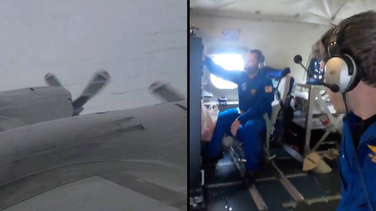
Ever wondered what it’s like to take a joyride straight into the eye of a hurricane? Well, the National Oceanic and Atmospheric Administration’s (NOAA) team of so-called “hurricane hunters” just gave us a front-row seat to a bone-rattling ride through Hurricane Milton! As the storm prepares to lash out on Florida’s coast, they’re braving turbulent winds and torrential rain to gather critical data that might just save lives. With parts of Tampa Bay forecasted to see insurmountable flooding—up to 15 feet, mind you—it’s no surprise that millions have decided to hightail it out of town, clutching their prized possessions like it’s a game of hurricane musical chairs! But in the thick of the chaos, these brave souls are strapping in and soaring through the storm, turning into some sort of airborne weather station… that inevitably leads to some thrilling, albeit terrifying, turbulence! So why do they put themselves through this? Well, sometimes you need to literally ride the storm to make sense of it! Strapping in for this wild journey, one pilot humorously asks a colleague to grab his wallet, proving that even in the fiercest weather, life goes on—pocket change included. Curious to learn more about their harrowing adventure and the data-gathering mission behind it all? LEARN MORE.
‘Hurricane hunters’ in the United States have shared footage of the terrifying trip they took to the eye of Milton ahead of it reaching the Florida mainland.
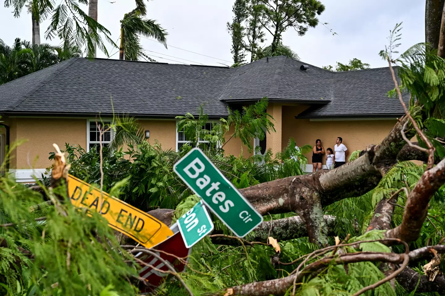
Hurricane Milton has hit the US state, with the likes of Tampa Bay expected to see up to 15 feet of surge water as flooding takes over almost the entire west coast of Florida.
Millions of residents in Florida have upped and left, taking what valuables they can with them, and countless people are expected to be left with ruined homes as a result of the storm.
Alongside the surge water, wind gusts of up to 200 miles per hour are set to have devastating effects. Sadly, some people have already lost their lives, with at least two fatalities currently recorded by officials.
Over on social media, the National Oceanic and Atmospheric Administration’s (NOAA) Aircraft Operations – dubbed ‘hurricane hunters’ – have put out footage of the work they have done to help map Hurricane Milton’s path and ultimately help save lives.
The footage shows the Aircraft Operations crew flying directly in to the storm. And given the conditions, the turbulence is some of the worst you’re likely to see footage of.
One video from Nick Underwood, a Programs and Integration Engineer with the NOAA, shows torrential rain battering the Lockheed WP-3D Orion aircraft as it journeys towards the eye of Hurricane Milton.
Inside the plane, items can be seen being thrown around the aircraft with crew only kept in their seats by the security of their seatbelts, with limbs flailing as they grab on to things to keep their seats.
Posting a video of their trip, the NOAA AircraftOperations crew wrote: “Bumpy ride into Hurricane Milton on NOAA WP-3D Orion.”
The aftermath of a tornado caused by Hurricane Milton (CHANDAN KHANNA/AFP via Getty Images)
The purpose of the NOAA’s dangerous trip in to the hurricane was to help map data to improve theforecast and trajectory of where and when Milton might hit land across Florida.
At one point in the video Underwood is heard going ‘holy crap’ as he is forced to grab items so they don’t fly away inside the aircraft.
Speaking to a colleague, he joked: “When you get a chance, can you grab my wallet too? Gotta keep these pockets zipped.”