NASA’s Stunning New Space Photo Reveals Devastating Hidden Secrets of Kentucky’s Deadly Tornado Damage
The Deadly Tornado That Ripped Through Kentucky
The May 16 tornado touched down near Whittle, Kentucky, just after 10:30 p.m. As it roared east, it ripped the bark off of trees, threw houses from their foundations, and tore a high-tension power pole from the ground and threw it hundreds of yards. It lifted at 11:56 p.m. after traveling 55.6 miles.
The twister also killed 20 people, including 17 in Laurel County alone. The other three deaths occurred in Russell and Pulaski Counties.
The National Weather Service rated the twister an EF-4 on the Enhanced Fujita scale, which rates the severity of tornadoes based on wind speeds, which are estimated from the damage left behind. This tornado reached speeds of up to 170 miles per hour, making it one of the strongest to ever hit the area.
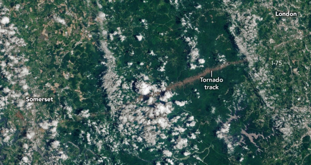
The storm’s power is evident in a new photo released by the NASA Earth Observatory. The satellite image, which was captured by Landsat 9, shows a distinct brown mark on the Earth’s surface that the tornado carved through Daniel Boone National Forest.
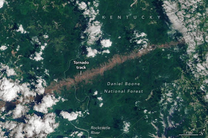
NASA Earth ObservatoryThe scar indicating the tornado’s path is labeled on this satellite image of the resulting storm damage.
The twister reached its widest point in the forest, leaving behind the mile-wide path of destruction seen in the image.
How Tornadoes Are Changing Across The United States
The frequency of tornadoes in the U.S. has slightly declined over the past few years. However, the places where tornadoes strike most frequently have started to shift from the Midwest to the Southeast.


Post Comment