Unlock These 62 Uplifting Stories That Will Instantly Brighten Your Day—You Won’t Believe #17!

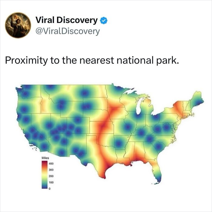 The United States has 63 designated national parks, but the broader National Park Service system includes more than 400 sites, ranging from national monuments and battlefields to historic parks, seashores, rivers, and recreation areas.
The map measures distance in miles, as shown in the key. Dark blue and purple indicate areas closest to a national park, while yellow, orange, and red represent greater distances. The biggest takeaway is how much easier national park access is in the western United States. The West contains dense clusters of some of the country’s most famous parks, including Yosemite, Yellowstone, Grand Canyon, Zion, Glacier, Olympic, and Rocky Mountain. California, Utah, Arizona, Washington, and parts of Colorado are particularly well covered.
By contrast, the orange and red areas highlight regions where residents may be hundreds of miles from the nearest designated national park. Much of the Great Plains, along with parts of Texas, Louisiana, Mississippi, Alabama, and the upper Northeast, have larger gaps in access. That does not mean these regions lack protected or scenic public lands. National forests, state parks, wildlife refuges, historic sites, and national monuments may still be nearby. They are simply farther from a site that falls specifically into the “national park” category.
 During construction of Naples’ Metro Line 1 in the early 2000s, archaeologists made one of Italy’s most remarkable urban discoveries by uncovering several ancient Roman ships buried beneath Piazza Municipio. Dating back nearly 2,000 years, the vessels were part of a thriving Roman harbor, alongside preserved docks, warehouses, tools, and everyday artifacts that offered a rare glimpse into life during the height of the Roman Empire.
The excavation transformed the construction project into a major archaeological effort, with experts spending years carefully preserving the finds before work on the metro resumed. Today, the discovery is considered one of the most significant archaeological finds in modern Italy, highlighting how layers of history can remain hidden beneath some of the world’s busiest cities.
That changed in 1877, when Thomas Edison introduced the phonograph, the first machine capable of recording and reproducing sound. His first recording featured him reciting the nursery rhyme “Mary Had a Little Lamb.” For the first time, people could preserve actual voices and listen to them again, rather than relying on written accounts of what someone had said.
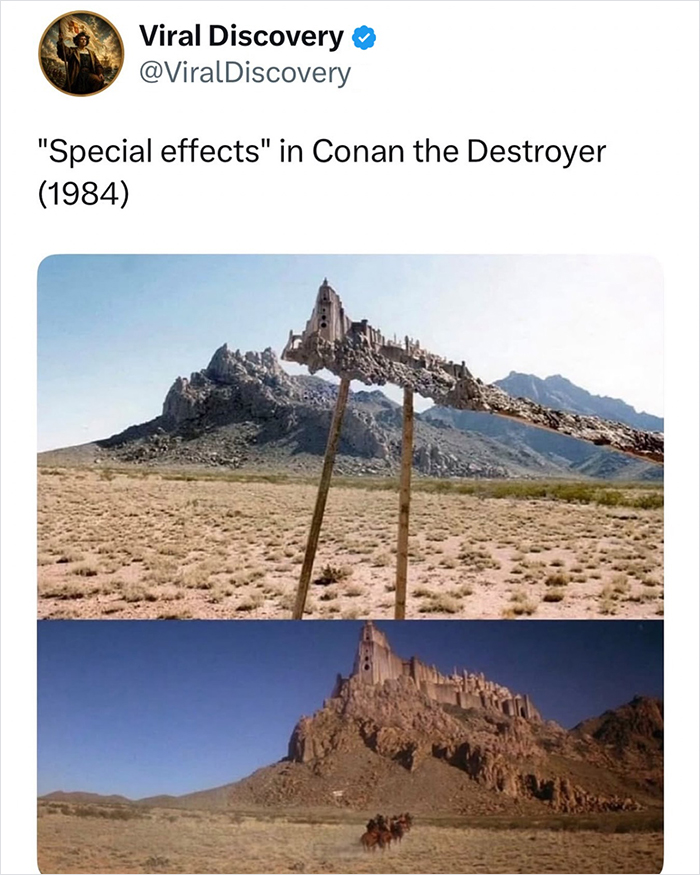 Practical special effects in Conan the Destroyer (1984) relied heavily on ingenious foreground miniatures and forced perspective created by legendary Spanish effects artist Emilio Ruiz del Río. By positioning highly detailed, small-scale physical models close to the camera lens while placing actors far in the background, the crew made small props of castles and temples appear massive.
This entirely practical, in-camera method required exact lighting and precise physical alignment to merge the miniature seamlessly into the live-action environment. Because this fantasy movie was made long before digital visual effects became standard, these physical illusions gave the film a rich and tactile sense of reality that holds up remarkably well today.
 After learning that three of their four children were gradually losing their vision, Quebec parents Edith Lemay and Sébastien Pelletier decided to give them something unforgettable: a year traveling the world.
Their children Mia, Colin and Laurent were diagnosed with retinitis pigmentosa, a rare inherited condition that progressively damages the retina. Their brother Léo does not have the condition. The family traveled through countries across Africa, Asia and beyond, filling the kids’ “visual memory” with wildlife, landscapes and new cultures while their eyesight was still strong.
Their journey later became the National Geographic documentary Blink, which follows the family as they focus on experiencing as much of the world as possible instead of letting the diagnosis define their lives.
 You can practically see the tectonic plates without anyone labelling them
Earthquakes are not randomly scattered across the globe. Instead, they occur in distinct belts that closely follow the boundaries of Earth’s tectonic plates, where massive sections of the planet’s crust are constantly moving. As these plates collide, pull apart, or slide past one another, stress builds up over time until it is released as seismic energy, producing earthquakes.
This is why regions such as the Pacific Ring of Fire, the Mid-Atlantic Ridge, and the Himalayan mountain belt experience frequent seismic activity. The consistent clustering of earthquakes along these plate boundaries has been one of the strongest pieces of evidence supporting the theory of plate tectonics, making it a fundamental concept in geology that has been taught for generations.

Fire Cloak - 1500F CE Certified Emergency Fire Blanket for Home & Kitchen | 500GSM Fabric & 0.5mm Thick - Silicon Coated 100% Fiberglass Essentials in House, Warehouse Office - 39"L x 47"W by Supa Ant
$73.99 (as of November 3, 2026 01:06 GMT +00:00 - More infoProduct prices and availability are accurate as of the date/time indicated and are subject to change. Any price and availability information displayed on [relevant Amazon Site(s), as applicable] at the time of purchase will apply to the purchase of this product.)
Joking Hazard Enlarged Box Empty Box for Card Storage
$12.00 (as of November 3, 2026 01:06 GMT +00:00 - More infoProduct prices and availability are accurate as of the date/time indicated and are subject to change. Any price and availability information displayed on [relevant Amazon Site(s), as applicable] at the time of purchase will apply to the purchase of this product.)
RIVER OF GOODS LED Boho Ceiling Fan with Hand Woven Brown/Natural Rope - Macrame Knot Work and Hemp Rope Style Eclectic Cottage Decor - 52" L x 52" W - Rich Barnwood/Light Driftwood Fan Blades
(as of November 3, 2026 01:06 GMT +00:00 - More infoProduct prices and availability are accurate as of the date/time indicated and are subject to change. Any price and availability information displayed on [relevant Amazon Site(s), as applicable] at the time of purchase will apply to the purchase of this product.)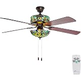
RIVER OF GOODS Stained Glass Magna Carta LED Ceiling Fan - 52" L x 52" W - Tiffany Style - Flush Mount Ceiling Fan with Remote - Teal
(as of November 3, 2026 01:06 GMT +00:00 - More infoProduct prices and availability are accurate as of the date/time indicated and are subject to change. Any price and availability information displayed on [relevant Amazon Site(s), as applicable] at the time of purchase will apply to the purchase of this product.)




















Post Comment